Required User Level
1 - View
The minimum user access level a user must have
to use this feature of Pimarc.
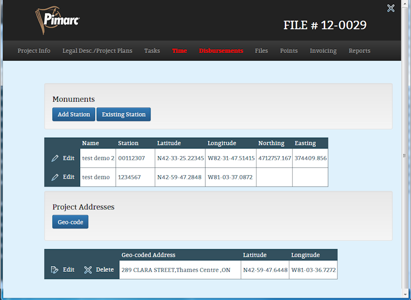
The Points section is where monument tie in information can be recorded and where project street
address can be Geocoded.
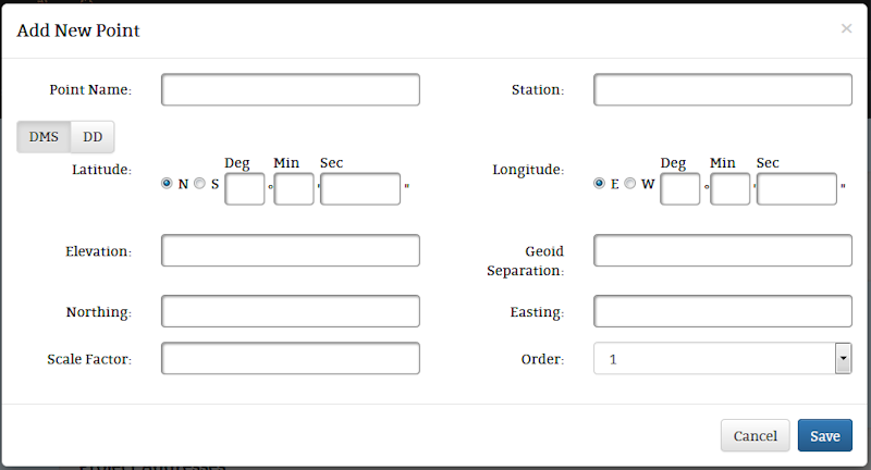
To add a new monument station just click on the "Add Station" button, enter all the information
there is about that monument and click on the save button. The point name is specific to the
project the monument information is being associated to. The rest of the information about that
monument is saved and can be associated to other projects.
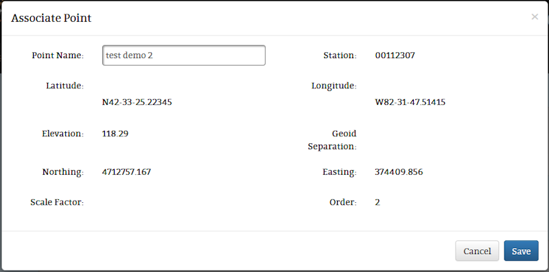
To associate existing monument information to a project just click on the "Existing Station" button.
This opens the monument search page. Enter the station number in the station search field and
click on the search button. This page will now display any stations found that match the search
criteria. If no results are displayed then the user wil have to add a new station.Click the
button with the correct station number. This will open the next page that will show all the
monument information and give you a text box to record the point name that will be used for this
point by this project. Each station can only be list once for each project so once the station
is attached to the project it will not appear in the search results for that project again.
To edit the monument information, select the monument that needs to be changed and click on the Edit
button. As was said above the point name is recorded for this project only. The rest of the
information on this page is shared by all projects that are associated to this station so be
careful when changing station coordinate or detail informaiton.
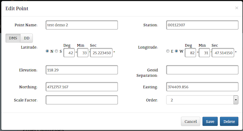
Be aware that if you delete the monument from this project the station is still in the system.
You are only removing the association to this station from this project.
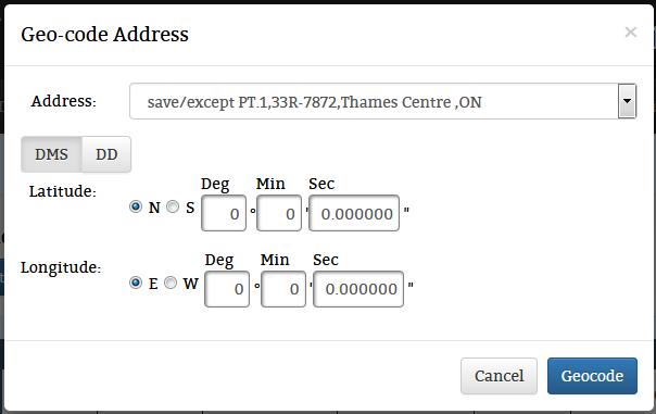
The Geocode button opens a window to allow the user to manually enter coordinates that match to the
addresses that have been entered for the project. When the window is open select the spacific project
address that will get a set of coordinates, select if you want to enter the coordinates in a degrees/
minutes/seconds or decimal degrees format. Remember that when using decimal degrees any number south
of the equator or west of the prime meridian will be a negative number. Once the longitude and
latitude number have been entered just click on the geocode button to save the coordinates.
The source for the coordinates to manually enter to match to the addresses are up to the user.
The user can get the coordinates from a GPS device or a surveyor total station. In the project
search with the Google maps integration it is possible to use the maps to find and record a
coordinate using the Google maps window.