Required User Level
1 - View
The minimum user access level a user must have
to use this feature of Pimarc.
To edit plan information just click on the Edit button beside the associated plan that you want to
change. Next to it is the delete button to remove the plan information. The next column contains
a button to view / download the plan if there is a digital plan attached. The rest of the columns
show details of the information that has been entered for this plan entry.

The image below shows the edit page for an attached plan.
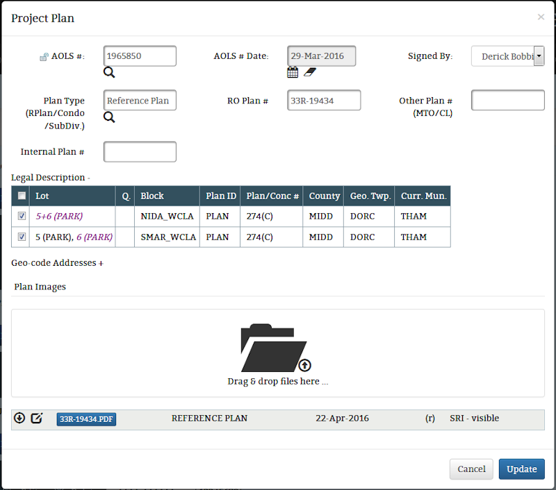
By default the legal description list is not expanded. It will need to be expanded if you need to
change which records are associated to the attached plan. You may also notice that this window
has an option to drag and drop files instead of the file select option that the add plan page had,
you can still select a file if you want just click on the background on either side of the drag
& drop folder icon  and the file select window will
appear.
and the file select window will
appear.
When dealing with areas outside of Ontario the AOLS information is not needed, so like the Add Plan
page for other regions the Edit page doeasn't show the fields required for AOLS information..
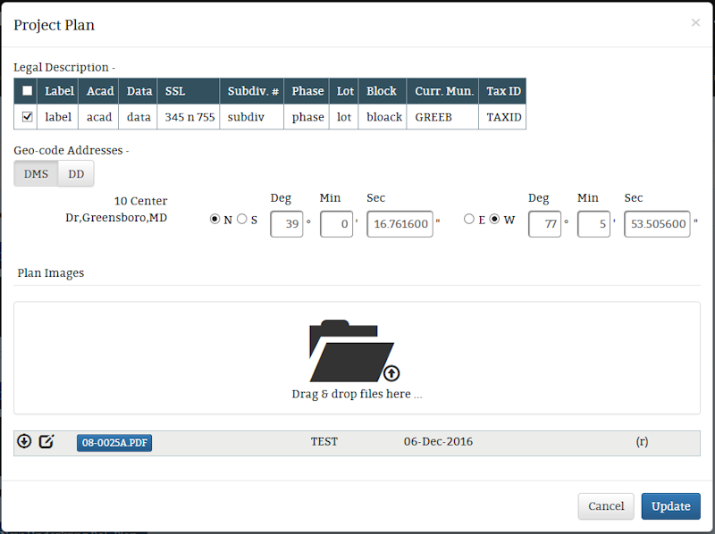
As with the Add page you can associate plans to specific legal description records, one, some or all
the records can be associated.
The Geo-code Addresses section is closed by default but it can be openned by clicking anywhere on the
Geo-code Addresses label. Then you can add or edit the latitude and longitude coordinates for the
address information entered for the project.